
Objective
Provide high-resolution multibeam data to monitor environmental dredging work.
Highlights
Performed high-resolution multibeam surveys to International Hydrographic Organization (IHO) Special Order Standards
Closely coordinated with environmental dredging contractor and the US Army Corps of Engineers (USACE)
Conducted multiple interim quick-response surveys to provide precise information
Project Details
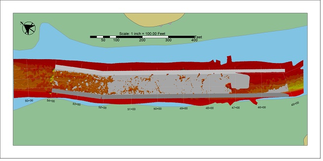
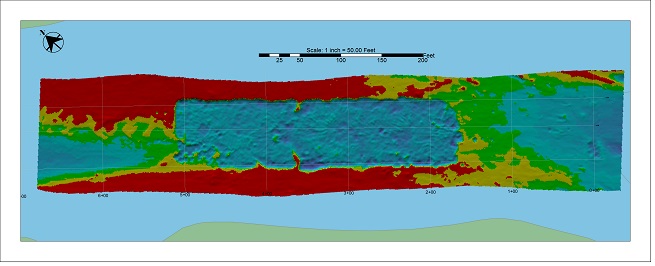
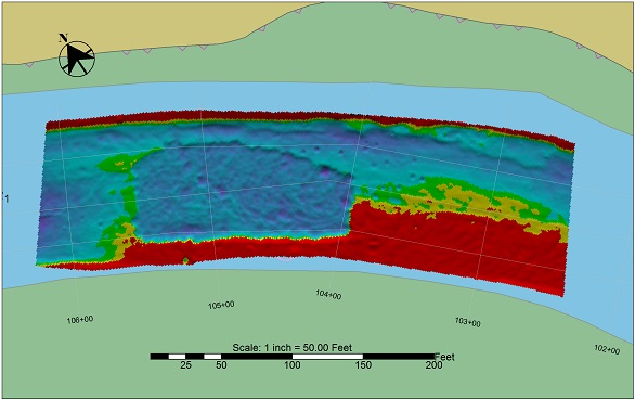
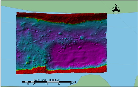
Substructure was chosen by the environmental dredging contractor to provide hydrograpahic survey support for a multi-phase navigation and environmental dredging project on the Cocheco River in New Hampshire for the USACE New England District. The dredging work for this shallow-water project included both excavator dredging of fine sediments and hoe ram work to remove several shoal rock areas.
The USACE required that multibeam SONAR be used for the pre-dredge, post-dredge, and interim surveys that were conducted in support of this project. Substructure not only executed the pre- and post-dredge surveys of the whole river, but also conducted numerous rapid-response interim surveys, which were used to quickly assess the dredging progress and to direct the contractor to specific areas requiring additional work. Because of the tight dredging tolerances required by this project, both Susbtructure and the dredging contractor relied on RTK DGPS to control all aspects of this project.
During the project, Substructure was involved in several meetings with the contractor and USACE technical representatives to discuss survey results and the dredging progress. Also, we provided a variety of interim data products to the contractor to clearly present the ongoing dredging progress and provided surface quantity computations throughout the dredging operations.