
Objective
Complete structural assessment and scour assessment surveys using multibeam echosounder in place of divers.
Highlights
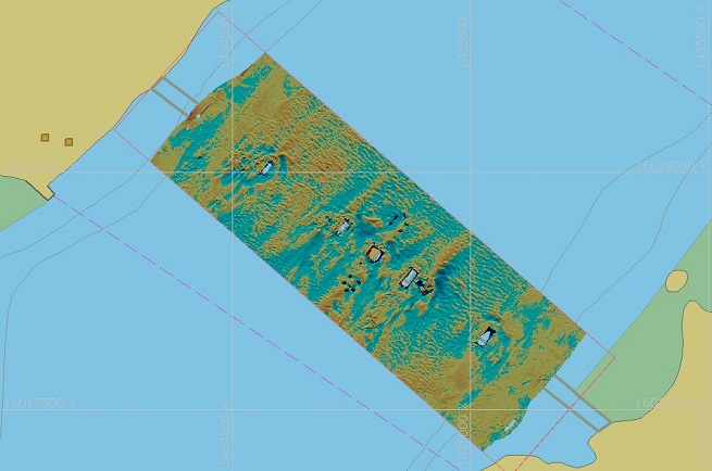
Acquired multibeam data to International Hydrographic Organization (IHO) Special Order standards
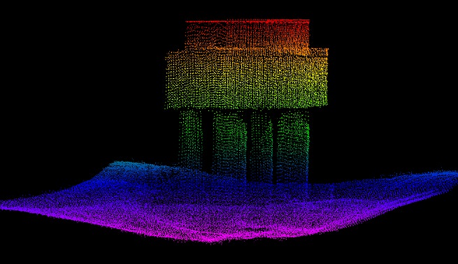
Used custom designed and fabricated mount to acquire maximum multibeam data of each structural support
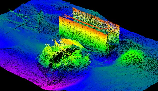
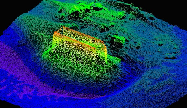
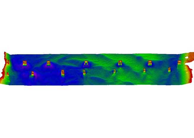
Provided high-resolution point cloud datasets around each structural support to enable assessment of structural integrity, as well as the extent of river bottom scour
Performed follow-up surveys to enable effective prediction of sediment change
Project Details
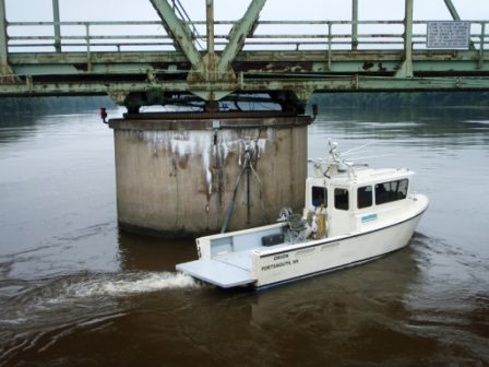
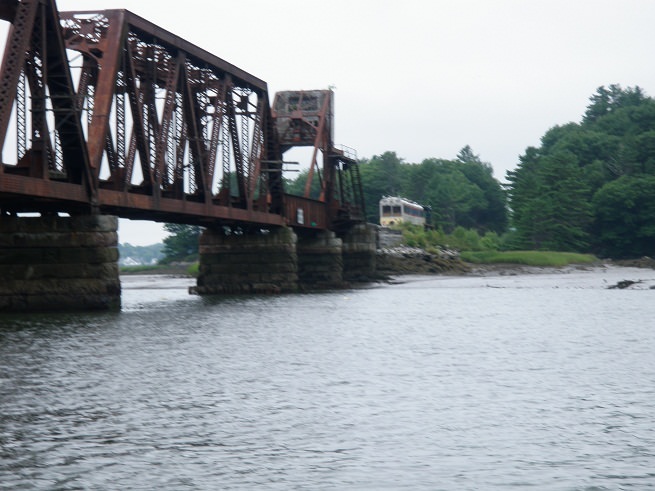
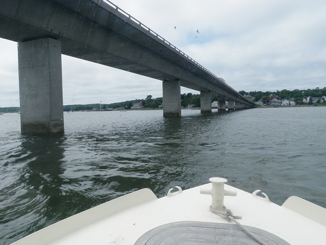
Strong currents and restricted visibility made underwater visual inspections difficult for bridges over the Kennebec and Sheepscot rivers in Maine. In these situations of reduced visibility, using a traditional diver assessment can be especially unreliable, as well as potentially unsafe. Safety concerns increased due to the strong currents on these rivers. To maintain a regular inspection schedule while mitigating these potential hazards, the Maine Department of Transportation (ME DOT) hired Substructure to conduct high-resolution multibeam surveys to assess these bridges. A bonus of using hydrographic technologies for the bridge assessments for ME DOT was the large datasets, which would enable the department to better assess scour in these areas.
For Substructure to maximize multibeam coverage of these structures, the R2Sonic 2024 transducer needed to be rotated outward 30 degrees. For this, Substructure designed and fabricated a unique mount, which utilized the same bolt pattern as the flat array mount but enabled the transducer to be mounted rigidly at a 30-degree angle. Due to Substructure’s previous design and fabrication work on the hull mount, a strong point existed from which the new mount could be built. The new mount was patch tested before use in survey to ensure it met Substructure’s accuracy standards.
Survey data provided to the Maine DOT included gridded products of the entire survey area, as well as very high-resolution point cloud data sets of all valid multibeam soundings around each structural support.
Follow-up surveys provided for an analysis of current conditions, as well as a complete assessment of the erosional and depositional patterns across the entire area. This information enabled a comprehensive evaluation of the scour potential around the structure, both for the near term and further into the future.