Objective
Acquire bathymetric data to inform navigational safety concerns for the arrival of a National Oceanographic and Atmospheric Administration (NOAA) coastal mapping vessel.
Highlights
Adhered to rigorous survey methods to produce multibeam data that satisfied International Hydrographic Organization (IHO) Special Order Standards
Obtained horizontal and vertical accuracies of less than 1.5 cm throughout the survey
Closely collaborated with both the University of New Hampshire Center for Coastal and Ocean Mapping (UNH CCOM) and NOAA

Project Details
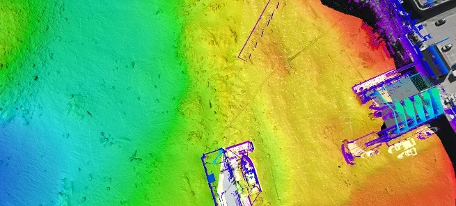
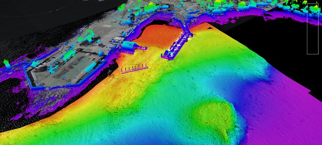
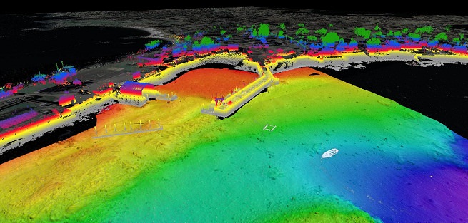
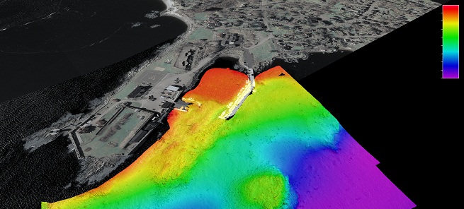
To prepare for the arrival of new NOAA Ship Ferdinand Hassler, a coastal mapping vessel, at the UNH Marine Research Facility in New Castle, New Hampshire, Substructure was selected by UNH CCOM to conduct a high-resolution multibeam survey to assess potential navigation safety concerns. Substructure used its custom-built survey vessel Orion, equipped with a hull-mounted R2Sonic 2024 multibeam echosounder and an Applanix POSMV 320 vessel position and orientation system, for this survey. The intent of this survey was to identify potentially small objects that could impact navigation safety around the UNH Marine Research Facility. To fulfill this need, Substructure’s primary data products were based on either a 20 cm minimum or CUBE grid surface. The CUBE uncertainties within the 20 cm grid were consistently within the 1-4 cm range. These extremely close accuracies enabled discovery of smaller, yet still potentially hazardous, objects, especially when in comparison with larger gridded surveys.
A particular challenge of this survey was the Marine Research Facility’s location, near the interface of a dynamic tidal river and the open ocean, because of the potential for highly variable water-column conditions, which could have reduced the accuracy of the survey. To overcome this obstacle, Substructure worked in close coordination with the NOAA tide station for tidal heights. There was close and consistent agreement between the NOAA data and the RTK data derived by Substructure. Substructure also used a YSI Castaway CTD profiler for frequent speed-of-sound profiles and a Valeport CTD sensor for continuous near-surface speed-of-sound profiles.